|
Penang Hills and Trails - Pantai Acheh Explorer 1, 2020 |
|||||||||||||||||||||||||||||
|
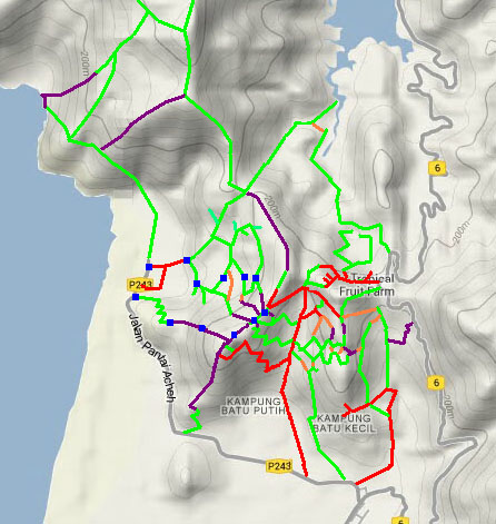
This is part of a series of pages on walking the hills of Penang. Click here for the index. This is a Grade 4 walk. There is a sketch map at the bottom showing the route followed. Please visit my Penang buses page for information on accessing the starting point, but to be honest the timings do not work well! There is a small hill (260 metres / 880 ft) rising behind Pantai Acheh village which we have visited just once. Today's hike was planned to go up it from the west side. Old maps show the hill as being part of the Chin Fong and Ban Aun estates so we knew to expect basically abandoned rubber above the lower fruit orchards and as always we planned to follow the ridge that they showed. Our starting point was this small Chinese shrine at the entrance to the village.
From a previous visit, we knew that a good track led up from the open gate behind the shrine. After a while there was a second gate. This was closed but readily skipped round.
We had a view north across the village to a ridge leading up to south of Bukit Batu Itam - it's on our 'to do list'. This orchard is well maintained with young trees going in to fill gaps and a good concrete path which zig-zags to the top of a small hill.
Here the view north looked across to Tanjung Gemuruh from where we had recently climbed to Bukit Batu Itam. To the west were the mangroves which line most of the coast in this part of the island.
The other half of the hill is abandoned rubber, it looked a bit rough to start with as usual, but inside it's quite clear.
We had to lose some height and while the col had a couple of trees down, there was actually an easy route through it.
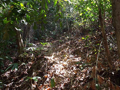
The climb was unremarkable, there was no path as such but invariably it was no problem to climb between the levels of the old rubber.
The number of rubber trees decreased as we went up as natural vegetation is taking over but there were few large rainforest trees yet. At one point there had been a significant landslide and the area around it had been occupied by ferns - best avoided!
The gap it created provided the best view so far, looking north into the National Park.
Yuehong had enjoyed a large Ais Kacang and a Char Koay Teow for dinner and she was smiling as the calories got burned off, this kind of country no longer holds any terrors for her. There were a few large boulders but these were easily avoided.
As we neared the top we found the prickly stuff in evidence, but again it was easy to find a way through it and 90 minutes after we set out we were on the summit.
Now all we had to do was follow the ridge in roughly a northerly direction. I had forgotten that there was a bit of a drop here but we merely had to avoid the steep slopes on either side. We rounded a boulder and the ridge started to flatten.
One of the disappointments this year has been the extent to which local wildlife is being assaulted. This wild boar trap was the third we had found. It didn't seem to be active but I dropped the gate just in case. We've seen one more near Malihom and another in the Bukit Relau Forest Reserve which we got Perhilitan to remove. Earlier this week I had liberated three small macaques from a trap above Titi Kerawang and relieved a bird hunter of a Bluetooth speaker which he was using as a bird lure near Pulau Betong. There's a real 'culture' problem in Malaysia, prosecutions do occur but they are relatively rare.
We were now on a path and emerged as expected into a developing orchard. Being on the ridge, there's not enough water so it's not much to look at. Ahead was the 'white house' and its access road which offered a way down towards the Sungai Pinang to Pantai Acheh Road. That was not an attractive proposition for us and instead we found our way back down along our regular route. I've not described it here, but it's not changed a great deal since my original report from 2016
On the way down we found the small Chinese temple doing a roaring trade, it was apparently the birthday of the resident God. The young man had plenty of customers who wanted their fortunes told.
It had been a successful outing, we'd done a new ascent and the Seng Hooi in Pantai Acheh and our restaurant in Sungai Pinang awaited. At some stage we'll have to do the south ridge too although that will need careful planning as we will need to park in Pantai Acheh and catch a bus back to the start,
|