|
Penang Hills and Trails - Sungai Pinang Horseshoe Part 2 |
|||||||||||||||||||||||||||||||||||||||||
|
This is one of a series of pages on walking the hills of Penang, click here for the index. This is a Grade 2 walk with a short Grade 3 section. There is a sketch map at the bottom showing the route followed. Please visit my Penang buses page for information on accessing the starting point. See also the Sungai Pinang Horseshoe Part 1 and Tiger Ridge Walk. The 501 bus service needed to get to Sungai Pinang from the north of the island had been withdrawn by September 2022. This makes this hike impractical for anyone without the use of a car. The descent below was totally overgrown by December 2023. We looked to climb this 'Road to Nowhere' in December 2019 and found it to be blocked by a landslide. Beyond the landslide area, the road is rather overgrown and our access to the ridge above it through the rubber would be 'difficult'. However, in March 2020, we went up the ridge from the end of the road to the top of the hill. Recently, we went into the hills behind Sungai Pinang for the first time, today was a second exploratory hike to build on what we had discovered the first time, deliberately we went in a clockwise direction whereas the first time we went anticlockwise. We took the 10.30 501 bus from Teluk Bahang as usual, got off in Sungai Pinang and walked down Jalan Pantai Acheh, it was warm and local children were cooling off in the stream. At electricity pole JPA 32 we turned right for the hills, we've been down here twice but this was the first time up. Further up it's designated as Jalan Lim Kai Ket, most of the side roads in this area have Chinese names. Rather than go where we had been before, we turned left at pole JPA 32 26
It was unremarkable save for its excellent condition and apparent lack of use. We disturbed a giant spider next to the road as we climbed steeply. The electricity poles soon stopped at the house on the left but the road zig-zagged on up.
Normally a new road or path brings a spring to Yuehong's step but today was hard going as the climb was relentless.
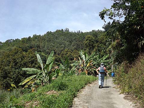
Ahead we could see the top of the hill above the next section of rubber while across the valley was the hill which we had climbed last time and behind the main range of hills leading to Bukit Laksamana.
Perhaps inevitably, as we got to the end of the ridge where it plunged downwards, it turned out to be the 'road to nowhere' ending at a point which was completely enclosed by a mixture of secondary jungle and very old rubber. We had just one card left to play to avoid a long trudge down, there had been a concrete path up into the young rubber not far back and this was our one and only possibility.
It was dated 8th February 2012 but was already falling apart despite having had little apparent use. Almost immediately it became a steep climb between the narrow terraces, but at least it went all the way to the ridge.
Time for another quick decision, go back or try that gap ahead... What gap do you say? Well the first 5 metres is always the worst and in no time we were on a good old fashioned unobstructed Penang ridge path, I've no idea who uses it but it was easy to make progress.
We've scarcely seen this kind of trail this year but it's likely to feature more now the wind has blown away the wet weather. We were really enjoying our selves when...
...we came to a recently cleared area. You get the idea, of course.
It seemed we could have followed some kind of fresh wide track down, but that did not appeal at all. Instead, we sat under the one remaining tree and had a snack. Afterwards, we passed along the ridge until we could see the hill top house which had been completed since we were last here in February 2013.
We could see right down to Pantai Acheh as before.
While there had been some clearance below the house on the Pantai Acheh side, it had yet to reach the durian estate and I guess should we have wanted to go down we would have been best to use the same basic route as before although necessarily it probably would look a little different now. That wasn't on today's agenda and we joined the end of the main road up at pole JPA 32 72. Looking in the opposite direction, it was clear that the next part of the hike was going to be anything but a challenge, someone had put a brand new road right where we wanted to go!
This is not the finest advertisement we have seen for sensitive development in Penang. At the top of the main road climb what used to be a small path through to the other side is an earthen wall with a fence on top. It would be easy to go round it, but I don't really want to see what they have done on the other side. You can see what it used to look like if you want. The new road certainly sped things up but it is sadly lacking in shade and it will be many years before that is rectified. (To be fair, by December 2016, the fence had been removed, access was again possible and the bare surfaces had some plant cover on them.)
When we got to the ridge, at first sight it seemed that for the second time today we had chosen a 'road to nowhere'. Upwards to the left was a small patch of rubber with a couple of huts, no use to us at all. To the right was unfinished business.
It went for all of 100 metres and stopped in front of some ferns. Now I would have checked ahead anyway, but I had cheated, I had already been here by following the original ridge path and I knew we could readily go down from here, the path was just a couple of metres ahead.
This path down was completely overgrown with ferns by December 2023. It was a pretty miserable path, badly worn and quite steep but it was a path. Soon we could see a house below and beyond it a road with a bridge but Yuehong's body was complaining, much as it used to do in the bad old days.
I knew we had looked down on something like this on our first visit a week before, but neither house then had a blue roof. So we made our way down past it looking for the pole route and sure enough there was another house round the corner. Unfortunately, the path to it was not in the best of condition, cue more frowns.
I knew we could have gone back up about 100 metres and retraced our footsteps from before but there was always the possibility of a more direct route ahead. The house was a ruin but beyond was a concrete path skirting the durian estate and heading down. It was extremely inviting and indeed we soon saw a motorcycle coming up and a house behind. As ever, the occupier viewed us with some surprise but when I asked 'Sungai Pinang?' he pointed down and smiled. Round the corner we went and then it was 'game over', just ahead was a junction we had been to previously and we would be in Sungai Pinang in 20 minutes.
I had been drinking water and Tiger all hike without any apparent effect and, since I prefer the latter, I carried on taking the medicine. Yuehong still wasn't looking too happy when we got to Balik Pulau, but the sight of my duck rice suggested her cure. Once again, she had been hungry!
It had been an interesting walk, a real curate's egg, parts were excellent but there were stretches that would make me think twice before returning to the area.
|