|
Penang Hills and Trails - Rain Gauge Challenge |
|||||||||||||||||||||||||||||||||||||||||||||||||||||||||
|
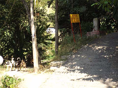
This is one of a series of pages on walking the hills of Penang, click here for the index. This is a long Grade 3 walk. There is a sketch map at the bottom showing the route followed. Click here for a list of the known PBA rain gauges. Please visit my Penang buses page for information on accessing the starting point. This account is linked from my Penang Peaks page which lists peaks over 400 metres as well as other places of interest and viewpoints. To find other hikes which visit this peak please check the maps of this are using this link. Of the major peaks in Penang, Bukit Elvira is probably the least visited. I've long looked wistfully at it from the Balik Pulau hills and back in December 2012, noted what appeared to be a path up towards its summit. However, that turn off is a long way from any start or finish point for a walk and exploring it would have left very little 'recovery time'. I was therefore indebted to Peter van der Lans who eventually checked it out a few days before this walk. He also suggested combining Bukit Elvira with a walk up from the Air Itam Dam to the Tiger Hill ridge and this I did. The result was an excellent six hour plus walk, the first four hours of which were primarily on good jungle trails. The reason for the title of this walk will become apparent later. It was a late decision to do this walk, Yuehong had developed a nasty sore behind her ear and was confined to barracks, I was uncertain as to whether she would want to spend so long in the jungle on unfamiliar tracks. In the event, they were all in much better condition than I expected. In a perfect world, I would have avoided the walk up from Air Itam towards the Dam, but at least the buses were very cooperative and I was able to start at 10.00. This is the turn off, we did this climb too many times some years back, it's just a trudge up the concrete following the signs for 'Lean Fah Thong'. I could have turned left at the first temple, but I prefer the right road as being more shady. I didn't have to follow the signs all the way, but took this path to the left which crossed to the other side of the small valley. The welcoming committee were not 'farm dogs' and quite harmless. If you start from the dam, walk across it, bear slightly right and go down till you meet the concrete road coming up. Turn left and climb up it till you get to the steps shown in the fifth picture. It's then easy to return to the dam at the finish.
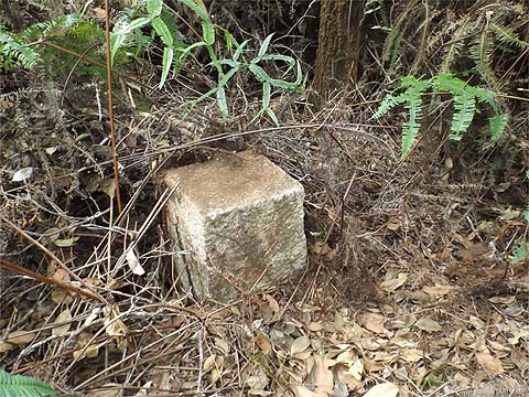
This brought me to a road where I knew I had to turn left and go up to a junction. Here I found the trail I would follow upwards for nearly an hour and a half. There's a large metal gate opposite, actually we had been told about this one long ago by PBA workers at the dam, but had never got round to trying it out... This part of the climb is quite steep as the ridge I would follow is some way up. I passed the first of many square stones I would see, 'F3' appeared regularly on this ascent. After 10 minutes I came to the only proper junction on this trail, the route from the left is an alternative entry from a little further down the hill.
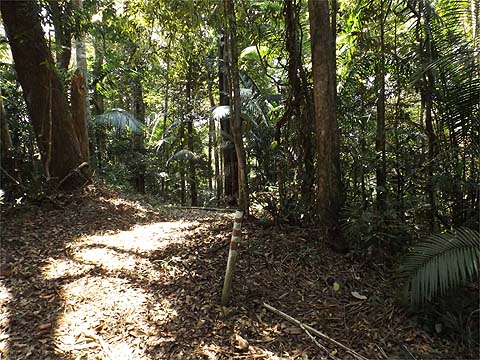
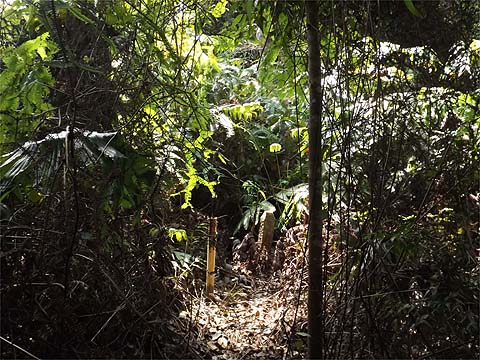
This path is definitely a 'Marmite' one, either you enjoy walking uphill through the jungle continuously or you don't. There are no views to be had and no real variation in the scenery. I find it strangely satisfying which of course is why I was here. After about 10 minutes, I came to the first of the day's five rain gauges, this is RG 28.
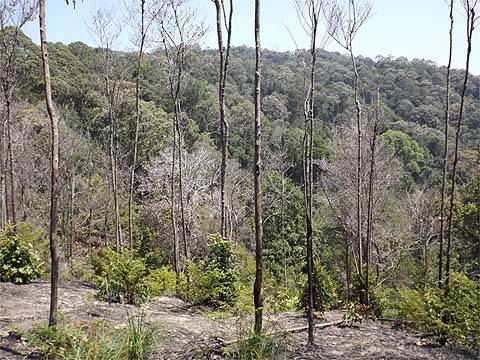
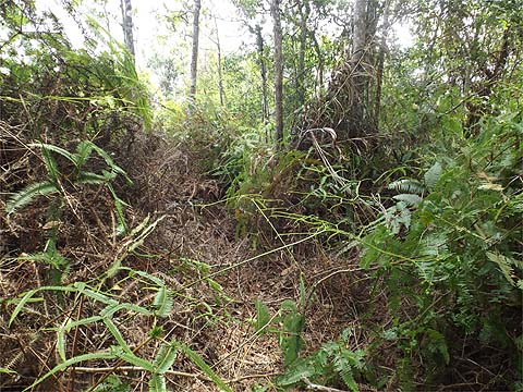
Some of the early parts of the hill had suffered fire damage a few years back, the effects were varied. Where the trees were not so tall, they had apparently been killed off, but then in many cases, they had started to grow again from the base, the roots had survived the experience. Where there were taller trees, by and large only the undergrowth had been consumed, the bark of the big trees had been damaged, in some cases fatally but mostly the jungle was recovering well, small fires being part of the natural cycle even in a place as wet as Penang. Bukit Kerajaan Forest Reserve is one of the largest on the island and, as such, more resilient than the smaller reserves further south.
It was not an unrelenting climb as there are three minor summits along the way where the path levels out and even descends slightly. I wasn't fooled, I knew it was going to take about one hour between the two rain gauges and eventually I got to RG 29. Many trees bear red paint and the F3 appears regularly too, quite why this has been done beats me as it's impossible to get lost. There are also innumerable square stones which define the path too.
So two hours after I had left Air Itam, I was on the Tiger Hill Ridge. To the right was a path to the main hill, which I expect to follow in a few days time to complete my knowledge of the area - there are very few paths as the map at the end shows. Today, I turned left and re-entered the jungle behind RG 29. After all the climbing, it was a real joy to follow this path, of course it's rarely completely flat as the ridge is undulating but generally sloping down here. At one point, someone has added some thick string as an aid, but it really isn't needed.
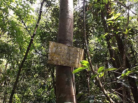
I took things very gently and it was nearly 40 minutes before I came to the faded yellow sign - no one in the state Forestry Department could be bothered to find a tree to attach it properly. This heralded a short drop down to the path up from Tiger Hill valley.
Now we come to nerd's corner, I'd passed RG 28 and RG 29 and ahead I knew I would pass RG 31 and RG 32. Hence today's big question which was "Where is RG 30?" as I haven't seen it reported. To me the most likely location was in the area ahead as the ridge path has been abandoned in favour of the path which skirts the small summit on the left hand (dam) side. So I took the (old ridge) path onwards and climbed up slightly and entered a quite recently burned area. Lo and behold, as predicted there was RG 30. It afforded me just about the only view of the day, looking back to the area I had just passed through.
The status of these gauges is a bit of a mystery to me as while most seem to be disused at best, access is clearly maintained to most if not all of them as I would find with RG 31 later. On inspection, several have electronic contents and I speculate that they are automatically recording data as opposed to the traditional hand method. Since they have no transmitters, they would have to be visited to retrieve any data. Here there was no obvious path onwards and I returned to the junction and on to the major landmark which is the well visited 5 way junction. It was nearly an hour since I had left RG29, but I had spent the best part of 15 minutes on my diversion. Of course, by turning left here you could return to the Air Itam Dam which would make for a very good shorter walk, especially if you had your own transport to park there. For me, I was now ready to start the second half of my walk, I'd been going three hours and there was plenty of time left to check out Bukit Elvira first hand. After 10 minutes, I passed another yellow sign and shortly afterwards branched left up the wide track, as explained, I was satisfying a long held ambition.
It proved to be a wide, well maintained path which I suspect is barely used. Now there are three 700 metre peaks close together in this area and the first one was just a small pimple marked only by the red striped pole. The last view is looking back up with yet another detached yellow sign.
As expected, there was not far to go till I arrived at RG 31. The path on was more like I would have expected, suggesting again that the access path was maintained by the PBA. Almost immediately it was blocked by a fallen tree, I had no problem skirting it but it wasn't then immediately obvious where I should continue. For once I was assisted by the presence of a yellow sign.
Soon I was climbing up towards the second summit, I don't know who uses this path, there are no indications that hikers or the hash use it and no local need at all. Maybe PBA people are sent here very occasionally, it's clearly historically a water conservancy path. The summit area is covered in ferns, presumably it's recovering from a fire, the path skirts it to the right.
The nearest I got to it was this yellow sign with two large unmarked stones next to it, I cleared the left hand one after I took the first photograph..
This seems to have been the major summit, the third peak is some way to the west on the other side of the road I had followed from the 5 way junction. Peter van der Lans had been here a few days earlier but it wasn't he who had bashed down the ferns. As expected from my examination of the terrain map, the path followed a gently sloping ridge in a south-easterly direction, there were glimpses of George Town on the left in the distance.
I am not alone in wondering where the Reverend Robert Hutchings and his wife Elvira had their bungalow up here, apart from the obvious site at the peak, there is a point where the ridge broadens just before it starts to drop away more steeply. From here downwards the path was the least satisfactory of those I had used, but never at all difficult.
Now these descents are notoriously easy to get wrong but whenever, I might have felt I needed reassurance, I seemed to find a marker. As I neared the cultivated area, as always there was a transition to secondary jungle which closed in on the path. The thick gingers told me I was nearly there and some 90 minutes after leaving the 5 way junction I emerged into a cultivated area. The shock was such that I wished I could turn round and go back the way I had come, but I'd been going for over 4 hours and that was definitely not an option.
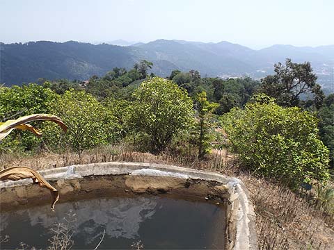
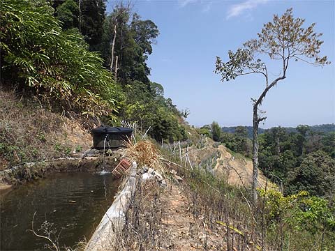
The reality is far worse than the picture implies, there are cleared terraces on both sides with RG 32 the saddest rain gauge on the island. Since RG 35 stands on the road up from the dam to the 5 way junction, I'm now on the look out for RG 33 and 34.
Should you want to try to do this walk in reverse (but I wouldn't recommend it) you'd have to persuade the farmer that you know what you're doing and climb up from the house to the rain gauge and enter the forest just to the left of the pond.
Outside the house is electricity pole NH 2 40 22 and at this point I walked down to the road to the 'Temple with the View', obviously meeting it at pole NH 2 40. Most readers would turn left here and go down to the col on the famous Air Itam - Balik Pulau Road and so back to where they started either in Air Itam itself or the dam above it. For my part, I had enough time to try a 'new' route down to Balik Pulau which had only recently come to my attention. I won't report it here as we have another visit planned to the temple very soon. This was a tough (6 hour plus) walk but immensely satisfying, I would unhesitatingly recommend it to anyone of like minded disposition.
|