|
Penang Hills and Trails - Over the Hills and
Not So Far Away |
|||||||||||||||||||||||||||||||||||||||||||||||
|
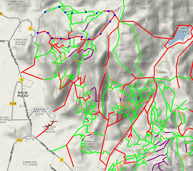
This is one of a series of pages on walking the hills of Penang, click here for the index. This is a Grade 3 walk, based mainly on length. There is a sketch map at the bottom showing the route followed. Please visit my Penang buses page for information on accessing the starting point. The 501 bus service needed to get to and from Titi Kerawang had been withdrawn by September 2022. This makes this hike impractical for anyone without the use of a car. Observant readers will note that this is some kind of 50th anniversary walk, which is pure coincidence, but if I had to pick one of all the walks on this page that is my instant all time favourite, then it would have to be this one. It's a long walk (we were out over 5 hours) and the length of the report reflects that. Anyway, sit back, enjoy your reading and make sure you too enjoy this walk before you die. I had read about this trail on the web (http://www.everytrail.com/view_trip.php?trip_id=1265986
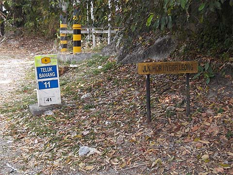
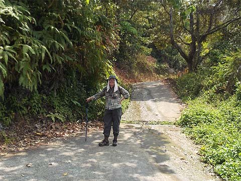
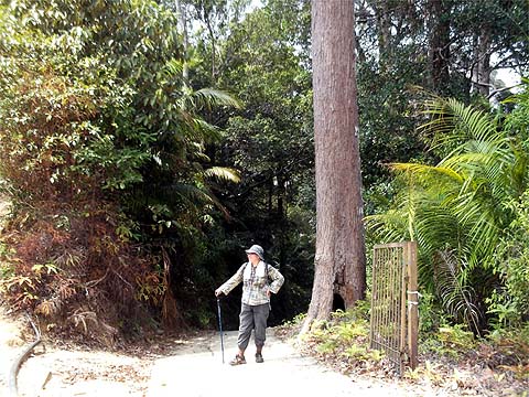
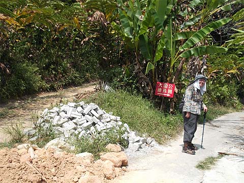
(Link broken by 1st November 2018) and The kicking off point is quite clear and the gate house sign has its usual warm welcome for visitors, but it's intended for those on 4 wheels who have no business here, not hikers and bikers. If everyone respects the wishes of those who control access then there's no reason to expect to see the road closed as is increasingly happening elsewhere. (Note added in March 2014 - there is now a gate across the road and access is impossible for any kind of motorised vehicle without the appropriate electronic 'key'. Good news in my book because a space has been left for walkers to pass - for a picture see the Titi Kerawang Minor Loop walk.)
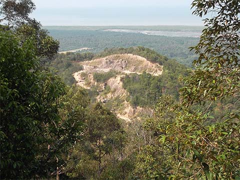
I have to say that this view got a bit repetitive in the nicest possible way and that's not dirt on the lens but a large eagle. On the right is a novel use for old tyres, foundations for this trail.
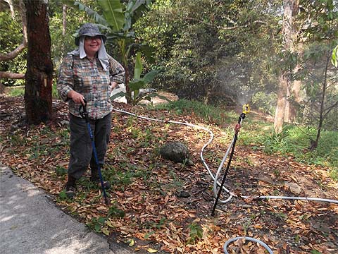
It's very much the dry season at the moment, we've been here for over 3 weeks and seen no rain at all (our UK home has seen record amounts fortunately we are on a hill side almost as steep as this). Hot walkers can cool off under the shower like the durians. The houses up here are total class.
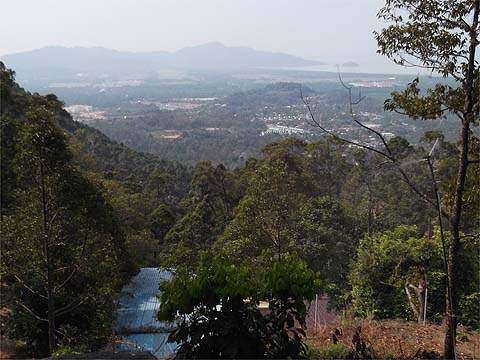
Did I mention the view? You just can't miss it...
Above Sungai Pinang village somebody has been borrowing some rock and soil presumably for all those houses to be built on what was formerly quite swampy. Round the bend, the view opened up over Sungai Rusa and down to Pulau Betong.
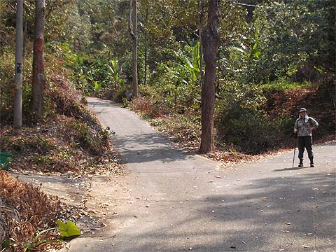
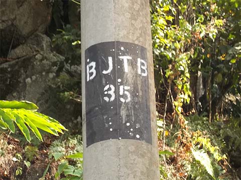
Shortly after we came to a 4 way junction; although I was aware of the perils of the right turn here, I hadn't appreciated just how much progress we had made and we made a short diversion along it. It produced a fine view of Sungai Rusa village which suggested an alternative ascent. Fortunately a passing motorcyclist questioned our sanity and sent us back from what was undoubtedly a dead end as far as today's walk was concerned (one up for Yuehong's Mandarin Chinese). We returned and continued our ascent on the road ahead and slightly to the left, note that the power line pole is labelled BJTB 35 here. A little higher someone had built a nice viewing gallery but we had to skip this as it was home to a number of sleeping dogs, so you'll have to take our word for it and be satisfied with a hint from the background.
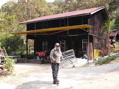
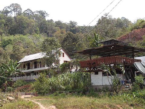
This was the classiest house we saw all day, a gem only viewed from across a valley. On walks like this, if you want views then you have to accept a certain lack of shade although there was a pleasant light breeze blowing throughout.
From time to time today, our guardian angels were working overtime and when we came to the next junction we had a choice of straight up or right and follow the power lines which had cut the corner hereabouts. We were all for going straight up when a couple of motorcycles roared up the hill and this time my Bahasa saved the day. Turn right it was and that's Yuehong standing on the correct route. As you can see, the hill was beginning to level out, if you don't pass this shrine then you chose the wrong road!
Two more distinctive landmarks appeared in quick succession. Based on information received previously, we correctly opted for the right fork, but I do fancy that gateway for another occasion...
The power lines finished at one last house which seemed to double as a dog farm, I lost track after I got to double figures but they appeared well fed.
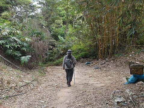
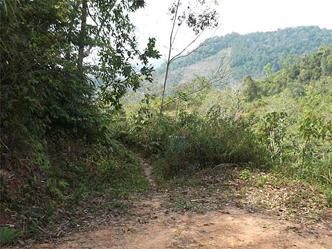
Durian now gave way to rubber and according to my sketch from the Everytrail map we were now indeed due another zig-zag. We had a short 'natural' section and emerged into a cleared area. The gate like every one we needed to pass today was left wide open, long may it stay that way.
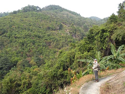
The view had changed, now we were looking down to Balik Pulau, the small ridge in the middle ground was where we had crossed a col on our Jalan Chai Horseshoe walk previously - trying to connect these two walks would be a challenge as there is still virgin jungle between. We have been assured that there was a path, once!
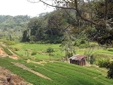
I remain to be convinced that bananas are an appropriate crop for these highlands, they need a lot of water and provide almost no ground cover, they are only good for a short term cash flow. By my reckoning (which is nothing like as good as it used to be), we were doing OK, only the sight of a wide path coming up from the right worried me a little as we needed to bear left. There was nothing to fear, where it joined us there was another track exactly where I would have wanted and round and slightly down we went.
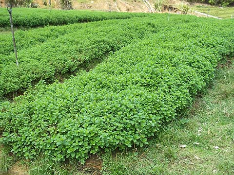
Beyond the vegetable area I recognised the hillside around the col with the 5 way junction above the Air Itam Dam, so we were very close to completing the first half of the journey. The second inappropriate crop in quick succession turned out to be 'mint' - the kind I serve with roast lamb, a near weed which was consuming vast amounts of valuable water.
I hadn't let on to Yuehong where we were and she trudged on to the junction. When she looked round and saw the sign, she suddenly brightened up as we did a U turn down the trail on the right. If you should be mad enough to want to go to the zoo that is Air Itam, then just continue up behind the camera. There is a description of this (in reverse) in the original Two Waterfalls report.
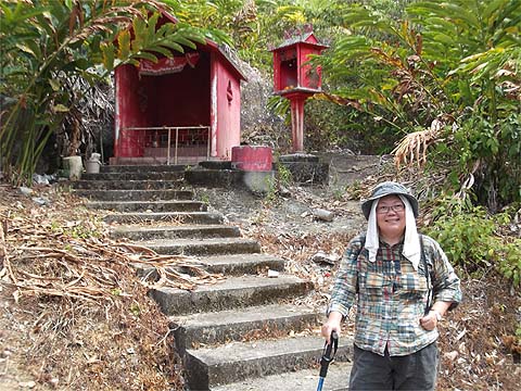
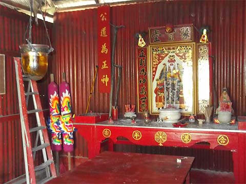
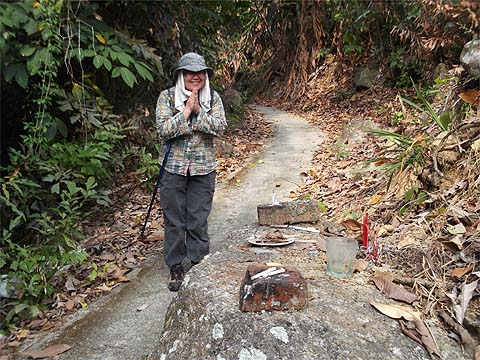
Very soon we were at the Da Ba Gong (Lian Jiao Yuan) temple, we had been told that the next day would see many devotees but there was no sign of any preparation. And why was she smiling? Simple, it was lunchtime and in anticipation of a successful repeat descent, the bread and jam was washed down with a bottle of beer.
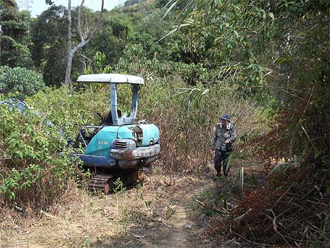
We continued beyond the temple, looking back, the silver globe of the Western Hill station is just visible on the horizon, it's probably still technically illegal to photograph it: . About now, the disadvantages of a liquid lunch became apparent. No sooner than we had passed a familiar sign from last time than we came to Y junction I did not remember. We tried right but I didn't feel comfortable with it. So we tried left and that was even worse, it just more or less finished at an apparently abandoned hut - if you see this digger like we did, then you're on the wrong trail. Back we went questioning my sanity, but once again the guardian angles saved us in the form of the owner of the aforementioned hut on his motorcycle who told us in excellent English that the right fork was what was wanted. Down we went again, noting an abandoned house below us which I ought to have recognised...
This is where you turn off just before the house. Obvious isn't it? By now I must have been suffering a major loss of confidence, because I tried to turn right down the hill at the next junction. Cue another guardian angel on a motorcycle who indicated we should instead head into the overgrown rubber behind Yuehong...
Fortunately, that was it for mistakes, we soon hit the durian estates big time and the descent became intuitive. Or maybe the beer had worn off.
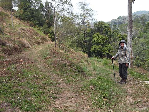
It's a lovely descent even if you have tired knees. The jury is out on its suitability for an ascent as there are so many junctions, I photographed them all and before we take a mid-term break, I have recklessly stated that I will sort out this route in reverse for once and for all without the benefit of GPS. For that trip, I have set aside two bottles of beer.
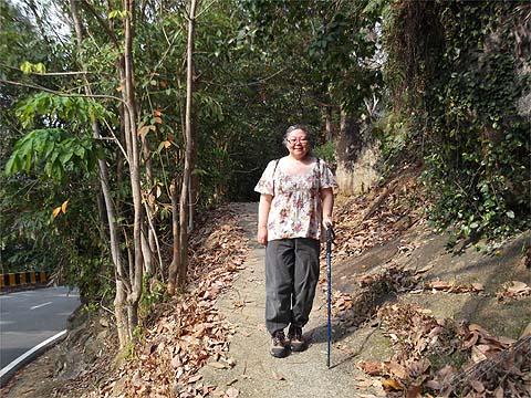
We had ridden our luck big time today, it would have been churlish not to have thanked the gods on our way out. After well over 5 hours on the go, we both smelled like an old Burmese goat. Yuehong had had the foresight to bring a little something along so she was not totally soaked in sweat as we emerged on the road.
We had an hour to wait for the bus with nothing left to sustain us but the contents of our water bottles and we walked up the road to the nearby Titi Kerawang tourist trap which was mercifully closed by now. The last 501 bus whisked us over the hill, we had a mountainous Nasi Kandar for dinner and headed home on the 101 bus. As I said at the start, this walk is ace, it should be right at the top of the hit list for anyone who wants to see Penang's walks at their very best.
|