|
Penang Hills and Trails - The Haunted House 2019 Part 1 |
|||||||||||||||||||||||||||||||||||||||||||||
|
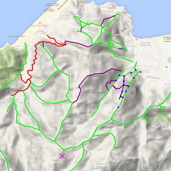
This is one of a series of pages on walking the hills of Penang, click here for the index. This is a Grade 4 walk. There is a sketch map at the bottom showing the route followed. Please visit my Penang buses page for information on accessing the starting point. We returned to this area 4 days later and followed the 'medium run'. referred to in this report. There was some overlap between the hikes at the beginning and the end, hence there are links in both reports to parts of the other. Nearly 3 years ago, we had hiked up from Tanjung Bunga to the Haunted House and continued onwards, first to Western Hill and Batu Ferringhi and then to The Crag on Penang Hill. As I made clear at the time, I was not terribly impressed by the path, its saving grace being that it was vastly superior to the alternative from the Botanical Gardens which is 'not fit for purpose' owing to its badly degraded state. Hence, I had quietly avoided a return since then. On this occasion, our friend Rexy had been told that there was at least one alternative ascent and he invited us to join him in checking it out. Assuming we were successful in our venture, we left open the question of how we would come down. It was a beautiful sunny morning and since someone had erected a tent in the middle of the road, it seemed a good idea to pop Mavis under it as there was no other shade available. We walked along and found there was a significant addition to the 'information board'.
The standard route up turns left almost immediately, but we were heading for the Sungai Kelian valley and continued past the first of many very recent pieces of hash paper. It seems we were inadvertently gate crashing the Penang International Hash Hounds 1000th run.
There was no chance any of the runners would get lost here, the place was festooned with paper. We continued in the direction of the valley but these days, I always feel the need to check out old houses in former rubber areas, this one was comprehensively abandoned.
All the PBA catchment signs in this area have 'Sungai Klean', it seems that their source maps are wrong and have never been corrected. Rexy had visited the outstanding art deco pumping station officially and reported that it was full of old equipment which is out of use as water is no longer abstracted here.
The valley floor is littered with boulders and the stream here is largely invisible under them. We were curious as to where the hash paper would go and climbed up to the main valley path.
Having got this far, Rexy pointed out that it wouldn't take long to reach the site of the 2017 landslide. There was no time to look in detail but in the unlikely event anyone had been here at the time, it would surely have been a terrifying experience. I believe it was only detected when the stream through Tanjung Bunga was found to be full of soil. The hash short run seemed to turn left here and the other two continue straight on up the valley.
Click here to follow the medium and long runs from this point. On this occasion we returned to the point where we had crossed the stream and headed up the hill past a few signs which were not of the usual ilk. There was no trail as such, it was just a case of taking the line of least resistance and the fact that I had forgotten my secateurs didn't matter at all.
The remains of the 'Hakka wall' were a giveaway, this is a former rubber area although the terraces have almost completely disappeared. This lower area contains many of the red barked trees that seem to do well in such places.
Rexy is very good on plants and he spotted this pair of small pitcher plants, distinctively different from the larger and more aggressive variety which colonise open degraded areas. There were marker signs off and on all the way up, mostly two kinds of blue plastic string but also unusual black and red ones.
Rexy monitored progress using 'high tech',. I preferred to note things like this stone which suggested we were following an old path.
The clear route and the markers went slightly left and we then joined a ridge upwards. On a more popular path, these boulders would have surely become a small shrine.
We were now into an area where there were large rain forest trees, the coverage was not dense enough to stop some of the morning sunlight from streaming through.
For some time we followed a gully typical for where a trail has been eroded by water over time. We eventually found ourselves on a distinct trail and then the hash paper reappeared.
This was obviously a major junction for the run, paper was everywhere.
Mere mortals were invited to turn left and go slightly down which would lead to the main path up, we turned right and joined the 'long run' upwards.
Rexy was in his element, rocks and trees here were adorned with a tiny orchid which was in its short flowering season , we were unbelievably lucky.
We continued up and found a flatter area in front of us covered in ferns. The paper went right and downwards which struck us as a not very good idea given our limited ambition was to get to the Haunted House which was to the left and above us. We returned to the turning and found markers to the left. Much to Rexy's surprise we started to descend steeply to a small boulder covered valley. This was a feature missing from 'on line mapping' and, as it turned out later, from all my conventional maps of the area bar a detailed one from 1945. I have frequently found contour maps of Penang to be less than reliable and this was the most egregious example yet. In future that map will become my 'go to' source before major explorations, on checking I noted that it alone also had the path from Pantai Mas to Bukit Batu Itam perfectly marked.
It was as well that others had been here before because the crossing point would not have been obvious, in fact were it not for spotting it through the presence of the supporting green string, we might have struggled. The small boulder perfectly blocked what would have been a deep hole and all we had to do was slide a couple of metres down it to the other side.
Opposite was, if anything, even steeper but the ferns were not as fierce as they looked.
We came to the top of the ridge and there was the main path. Yuehong's bad knee was complaining, a sure sign that two weeks conditioning had not been sufficient preparation for this demanding hike.
So Rexy and I went up to the Haunted House where I noted that the alternative path down to the opposite side of the Teik Quarry still seemed to be in use.
We returned to where we had left Yuehong and started to descend. This was just about the only highlight, another set of the small orchids, the length of the flower stem ensures that the tiny seeds will be caught by the slightest breeze. Rexy tells me that it's a Wispy Umbrella Orchid, https://en.wikipedia.org/wiki/Bulbophyllum_gracillimum.
The path is a mess and no advertisement for jungle hiking, we let Rexy go on rather than detain him with our slow speed. The view across to Mount Erskine needs absolutely no comment.
We were joined by the hash paper and later in the day hundreds of feet will have pounded this path and probably this cup fungus on a wooden step too into oblivion.
The greenwash brigade can never miss an opportunity to demonstrate their bad taste, whatever happened to the 'take nothing but photographs and leave nothing but footprints' principle? At least in a few weeks most of the hash paper will have disintegrated and started to rot down. On our second visit we removed all the plastic bits which were used sparingly at the junctions.
It had been an interesting expedition, fortunately we got back to base while the hash 'persons' were still gathering. We leaned that those on the long run would have made it all the way up to the Rain Gauge 9 path before turning left and heading for the botanical gardens before another left turn to the far end of the Vale of Tempe, far more than we would have wanted to do today. As we left, it started to rain... The back markers will no doubt had had a slippery ascent in places.
|