|
Penang Hills and Trails - Rimba Ridge Revisited |
|||||||||||||||||||||||||||||||||||||||||
|
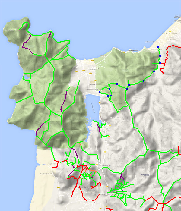
This is one of a series of pages on walking the hills of Penang, click here for the index. This is a Grade 3 walk owing to the steepness of some the ascents / descents. There is a sketch map at the bottom showing the route intended / followed. Click here for a list of the known PBA rain gauges. Please visit my Penang buses page for information on accessing the starting point. IMPORTANT By December 2023, the route from the Bayview Beach Hotel towards the Batu Ferringhi Reservoir past the 'Chin Farm' had been aggressively blocked by razor wire in the area where there is a gate by the water tank. There are also numerous signs stating "NO TRESPASSING - NOT A PUBLIC HIKING TRAIL" This will mean that there is no longer any access to / from any of these well known paths: 1. That to the Rimba at Teluk Bahang I do not know about current access through the main gate to the aqueduct above the former Holiday Inn. We did a similar walk in 2016, see the Rimba Ridge report. This walk was planned at short notice as two days earlier I had comprehensively cocked up the last part and we wanted to go back as soon as possible to work out what had gone wrong. This walk starts in the Rimba Forest Park below the Teluk Bahang Dam, readily accessible by taking the 101 bus to 'Escape' on the round-the-island road and walking 100 metres past Entopia (the former Penang Butterfly Farm). You're meant to register in the Forest Park office before hiking but the chances of a member of staff rushing out and accosting you if you don't is vanishingly small. They are all in their air conditioned offices playing with their smart phones and counting the days till their next salary payment. Just follow the main road up bearing slightly right, continuing on the steps and then up following a pipeline. This park map is displayed near the Kolam Mandi (Swimming Pool). The blue squares show the route we followed this time. The magenta squares show the route followed last time, that climb is also part of the traditional route to Bukit Laksamana, turning right at SMPG 12 instead of left. The two routes could be readily combined which is, in effect, the park's Trail 4 (Denai Pematang).
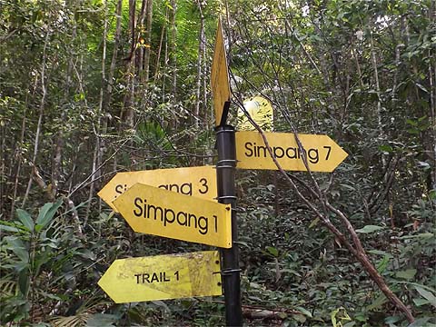
After scanning this notice, no one should get lost here, the paths in the park are all in good condition as far as we could see and the signposting is overwhelming. We soon got to Simpang 1 and took the signposted shortcut to Simpang 2 which involved a short climb.
Somewhat confusingly each trail has both a number and a name, the former appear at junctions, the latter along the route. In this case we wanted Trail 1 which would lead to Simpang 3.
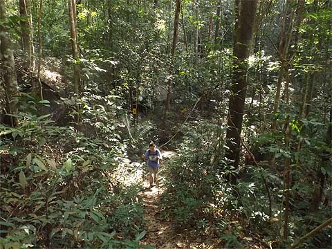
This is broadly a contour path and a pleasure to hike on. The various letters which appear along the way are points of interest explained (in Bahasa Malaysia) on the map board.
We got to Simpang 3 which we could have come to directly from the park entrance, only I had wanted to consult the map board. The information board here indicates that four paths share this point, the figure in brackets is the total length of the path (in metres) and the other figure indicates progress along it. Denai Pematang (Trail 4) officially runs anti-clockwise following the magenta squares on the map above and the back down the blue squares, hence this point is only 350 metres from the end and it means we would be counting down as we climbed.
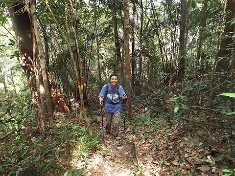
We now started to climb and got to Simpang 14 which is only a junction in the sense that there is an unsignposted path down to the left. This seems to be the northern boundary of the park.
Just a few metres further up is a viewing platform and I am pleased to say that unlike its counterpart at the top of Bukit Laksamana this one appears to be in good health. I have to say that we were both feeling a little rough today as we had enjoyed a delightful social evening with friends Nathan and Tom but it had run on rather late and we had caught what was probably the last but one 101 bus home.
Anyway, we couldn't leave without taking a couple of snaps of the view, it's real Beauty and the Beast stuff, Teluk Bahang and the National Park look good which is more than can be said of the reactivated quarry which appears to be supplying stone for the reclamation project which is destroying the traditional Gurney Drive and the top end time share which will bring precious few jobs and and not much money to the village. The completed high rise is the failed Mutiara Hotel which has sat derelict since before we started coming to Penang in 2010.
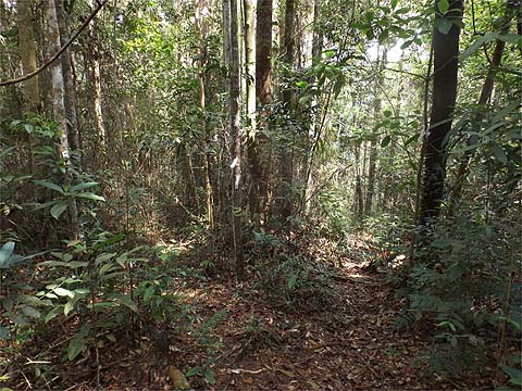
We started up and the trail had a very comfortable gradient so the signs seem to flash past, this one was 3250 metres.
Although it was quite sunny, the temperatures were not high as as we were walking mostly in the shade, the hats had been temporarily retired. Now we had got to 2950 metres and the summit would be at 2650 metres.
It was inevitable that the top section would be steep and roped as the other ascent was so equipped, this was 2850 metres.
There was no rush, we had plenty of time. It was officially designated a short walk so there were no jam sandwiches on offer, but there was plenty of water available.
On up we went and soon we were at the summit, the climb from the platform had taken 50 minutes. Coming this way had taken us 90 minutes in all, compared to nearly two hours on the slightly longer route, but the climb here had been in much better condition.
We now came to the best part of the walk, a ridge walk and all I had to do was remember to take the right fork at the first (and only) junction.
Our speed crept up a little, Yuehong passed RG 15 without a glance because it had been ticked off her list last year.
She was beaming as we took a refreshment stop and I got a non-stop lecture for the next 5 minutes or so as we approached the site of my earlier humiliation where the trail was blocked by a fallen tree.
"Look, this is where you should have turned left to regain the trail, you stupid man, look at the blue markers, you never listen to me."
There was no point in answering back, there never is once she gets going. From the way she was going on, you might have assumed that the path was perfect. In fact, because we had left the ridge, it was a whole lot stepper than our other route down.
I'm being unfair, parts of it were excellent and there were no fields of ferns to slow our progress.
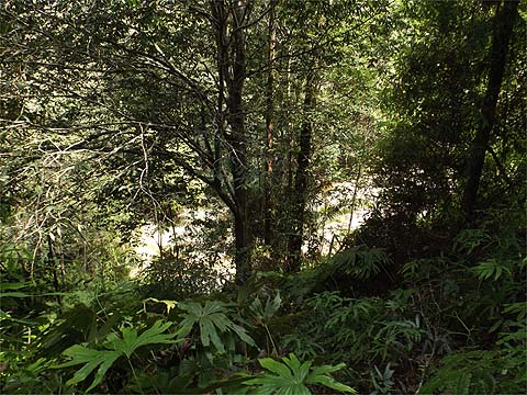
Soon we could see the streambed below the dam and there was just one last obstacle to progress.
Actually it was no obstacle at all, it was time for me to enjoy a Tiger. The second picture shows where the original path went just above the dam until it was fenced off. The newer path we had followed was unable to use the ridge up and hence was much steeper. It had taken barely an hour to come down from RG 15, the 'interesting' alternative had come in at two hours... It was a stark reminder of the need to immediately regain a jungle path once you have gone round a blockage.
Should you want to find this path to do the walk in reverse, at the moment it's quite easy because there's a brand new sign to show where you need to go into the forest just below the dam - if you can't find your way there from the Bayview Beach Resort it's just as well because you are obviously not equipped to take this route. Afterwards, turn immediately left and you will soon find the steep climb. Do not go straight on which was a marked path to the Rimba Park (the sign for it is still here just to the left), it is definitely not recommended as it is unsympathetic to the terrain.
I have to say we thoroughly enjoyed this walk as a detox to the excesses of the night before. I would even unhesitatingly use it in the reverse direction as the descent is far more acceptable than the alternative further south. As it was, we had started just after 10.30 and we hit the main road just four hours later, that indeed constitutes a short walk for us.
|