|
Penang Hills and Trails - Challenging Times,
Part 1a |
|||||||||||||
|
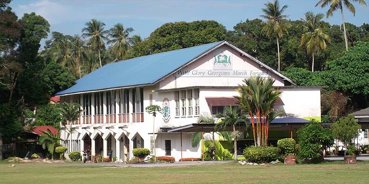
This is part of a series of pages on walking the hills of Penang. Click here for the index. This is a Grade 3 walk, veering towards a 4 based on terrain. Please visit my Penang buses page for information on accessing the starting point. One of the first things one learns about the hash is that it is easy to tell when the 'hares' are telling porkie pies - like politicians their lips move. So when the 3rd Penang Rainforest Hash Challenge (http://ph4.me/ link dead by 26th April 2014) promised gentle ups and rolling countryside, my suspicions should have been aroused. However, foolishly I assumed that they would not go out of their way to find 'paths' which are 'ball breakers' when the intended purpose of the exercise was to get as many participants as possible all the 28km way from Balik Pulau to Teluk Bahang. The trails through the rain forest of Bukit Laksamana would be more than enough without throwing in unnecessary extras. We made an early start, catching the 09.30 501 bus from Teluk Bahang (note since then the bus has been retimed, see above) and as it was unusually a Scania instead of a crappy Chinese Higer fit only for the scrap heap, we were on our way out of Balik Pulau just after 10.00, St George's School here clearly still recognises its heritage:
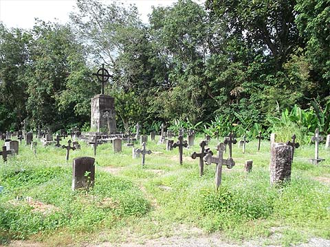
We headed up the road towards Air Itam and turned left into the cemeteries where the paper started. Instead of the usual exclusively Chinese graves, this one also had areas for Malaysians who were Christians. When the paper trail turned left on to a minor road, we followed it, bad mistake lah!
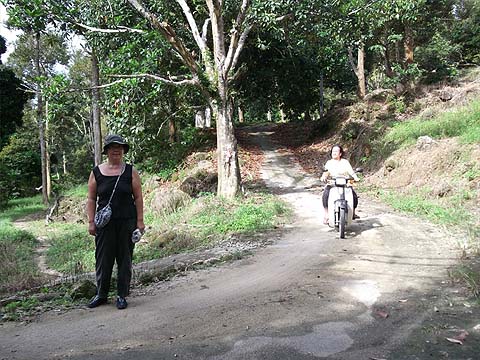
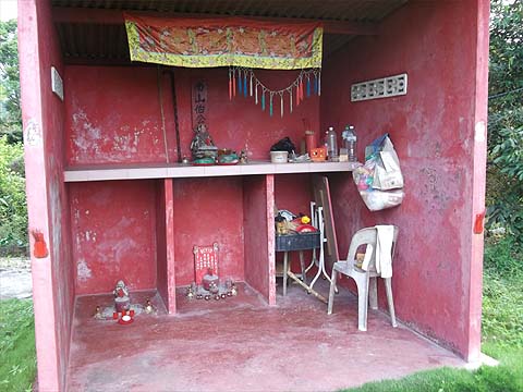
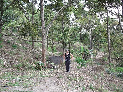
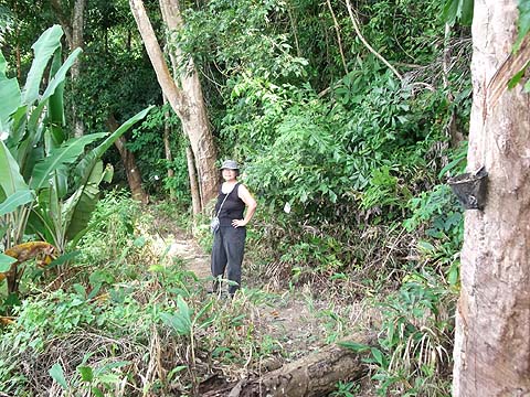
With the admirable benefit of hindsight, we should have just carried on with what would have represented an excellent short cut. Again the trail went left and instead of going directly up the hill, it meandered round until it met another road. And shortly after it left the road and meandered back to meet one of the concrete paths again. This should have acted as a warning that maybe someone had been using technology as opposed to brain. At this point we were still basically in durian orchards and for a while the paths were good, we even had a chance to say hello to yet another image of Tua Pek Kong.
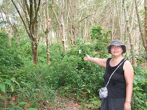
And at the top of that we started on the rubber, slightly overgrown but of course beyond it there was another durian estate with a perfectly good trail we could have come up directly instead.
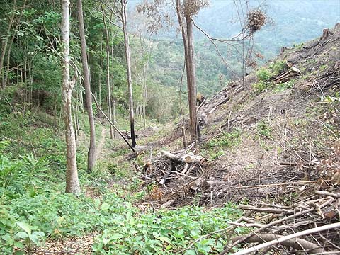
And then just when we should have been really motoring we were back into the scrub and then out into an endless alternation of near overgrown rubber and up and down scrambles where the 'hares' couldn't make up their minds which level to follow. This was one of the better bits.
Finally the penny seemed to have dropped that the ridge (path?) was too far above and the trail scrambled upwards to a small col where there was clearly a far better path coming up from the east side, it wasn't even as if we had previously had much of a view on the west side.
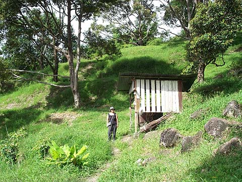
Once again the 'hares' left the ridge behind ignoring the nearby rubber levels and dumped us with a slippery 50m drop to another durian estate. Immediately after this we were on our way back up again to the ridge. Fun on a Monday night or whenever PH4 run but inappropriate for the task in hand. Finally we emerged at what seems to have been a never completed house next to an electricity sub-station on a substantial concrete road.
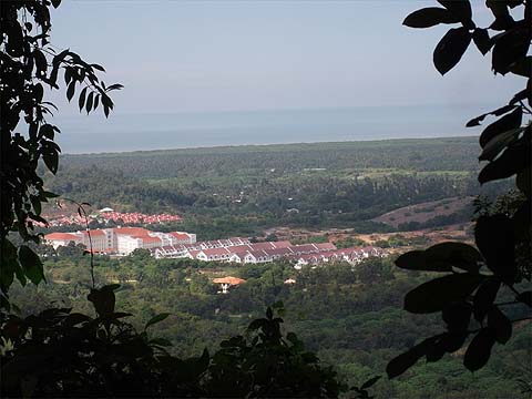
We had spent far too long messing around to get here (allegedly some 5km according to the paintwork). The hash trail continued up the concrete road for a while and then dived off into the scrub behind a rubber plantation. At this point basically we were still below the height of 'Bao Tian Gong' which we could see on the hill opposite. We followed the concrete road through the rubber to where it (and the electricity line) finished at a new house, someone in the garden said 'there used to be a path up to Bukit Elvira but it was impassable' - later we found that was not completely true. But for today we'd had enough, it wasn't the pleasant hike which we had anticipated following as far as the known path to Titi Kerawang which we knew to be ahead from our encounter with the trail six days earlier. So it was an easy decision to follow the concrete road back down to Balik Pulau, it would be easy to retrace our steps to this point if we ever wanted to continue the Hash Challenge route as it was lined with electricity poles as permanent markers. Again this view of Balik Pulau shows how little real distance we had covered...
In an hour we were back at the junction above the cemetery where we had turned off many hours earlier. In fact we were back in town in well under half the time we had previously frittered away in scrub bashing, so much so that there was plenty of time to start on a pile of rambutans and sink a jar of amber nectar before catching the last 501 bus back to Teluk Bahang at 17.30. It was by some way our most disappointing hike since we tried the Forest Park Trail between Batu Ferringhi and Teluk Bahang. Next time. no doubt, we'll be playing safe again. |